
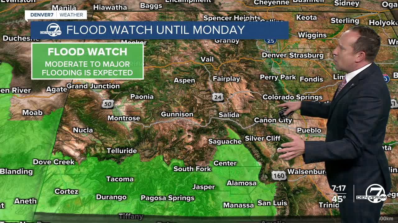
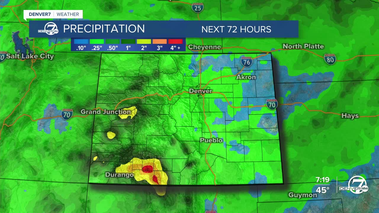
It's going to be a busy couple of days for Colorado as a strong and moisture-rich system impacts the state. Of highest concern will be the San Juan River in Pagosa Springs/Archuleta County, as historic river levels are expected here by Sunday evening. The current record river level is 17.8 feet, and the forecast is for the river to crest at 19.38 feet. Significant river flooding will be possible from Sunday evening into Monday morning. As much as 2-4" of rain in this area could lead to other flood threats, outside of river flooding.
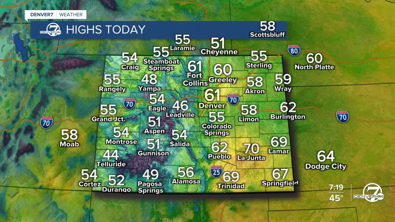
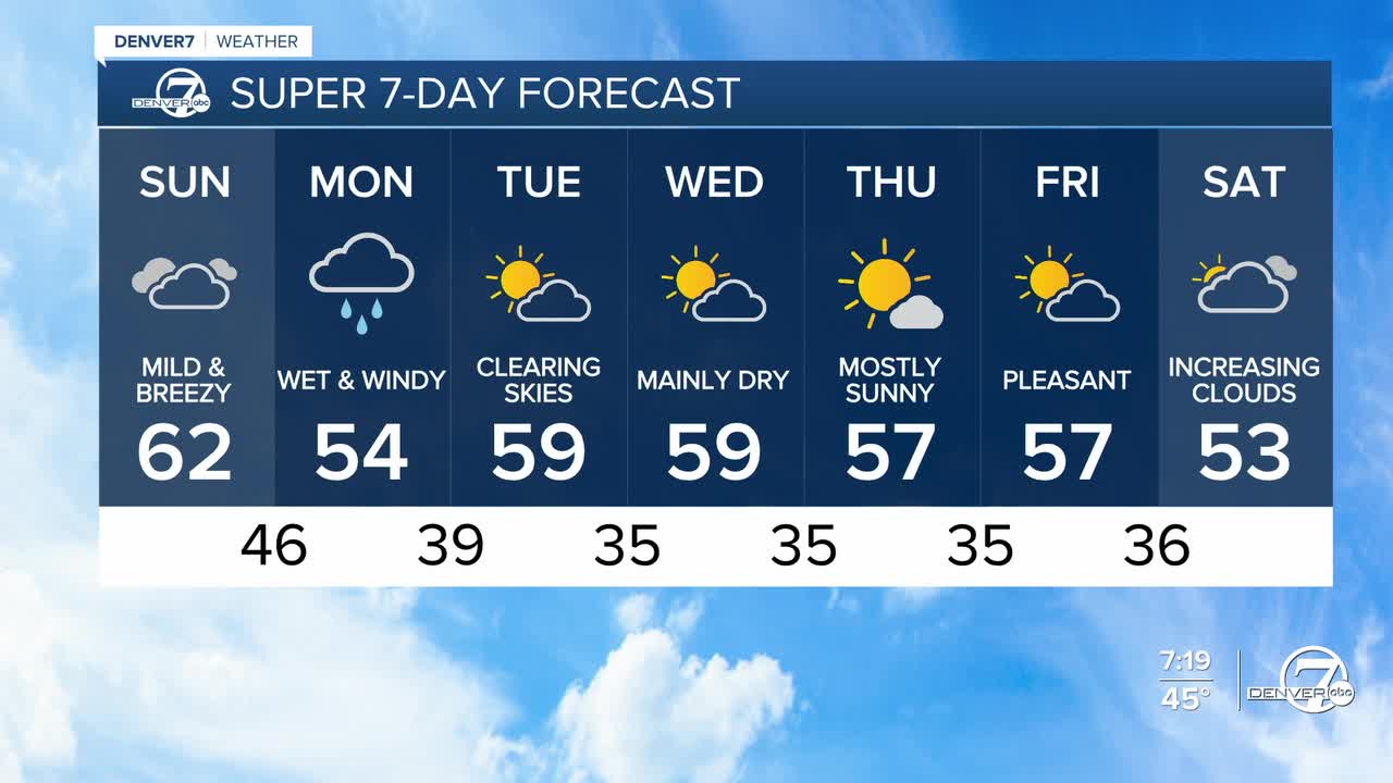
For metro Denver, our Sunday will be overcast, mild and breezy, but mainly dry. A few isolated showers will be possible this afternoon before rain chances pick up later tonight and Monday. Highs on Sunday will warm into the lower 60s. Temperatures on Monday will be much cooler, only warming into the lower to middle 50s.
A cold front Monday morning will set the stage for a cooler, wetter and windier start to the week. Rain showers will increase throughout the day, with rain lingering into the overnight hours before exiting to our east on Tuesday.
Snow levels will initially be high, up above 10,000 feet on Sunday before lowering to under 8,000 feet by Monday night to Tuesday morning, with some flakes in the foothills and along the Palmer Divide.
Highs will rebound to near 60 degrees on Tuesday and as we dry out, we'll be left with breezy sunshine by the afternoon.
A weak system moving across Southern Colorado on Wednesday could send a few showers our way by Wednesday evening. Otherwise, the rest of the week looks dry, with near seasonable temperatures in our forecast.
DENVER WEATHER LINKS: Hourly forecast | Radars | Traffic | Weather Page | 24/7 Weather Stream
Click here to watch the Denver7 live weather stream.


